Saturday, April 30, 2011

Briones Regional Park Hike


The rest of the pictures here

We used GPS tracker called "Move!Bike Computer" to log the data from our hike; you can view it using GoogleEarth. The batter on our phone only lasted long enough for the hike in (from parking lot to summit), so you can get an idea about where we went and the elevation changes. File here.

Briones is part of the East Bay Regional Parks system. This hike up Lafyette Ridge to a 1350ft. summit, which we took about 3 weeks ago now, was really excellent. Gorgeous day and a nice little climbing challenge over picturesque rolling CA hills with scattered oaks. We did 8 miles round trip and gained a total elevation of about 1000ft, but since the trail was so hilly (see GoogleEarth data above), it ended up being almost twice that. Some of the hills were literally 40% grades... yikes. I really regretted wearing jeans that day.

Monday, February 21, 2011

Yosemite in Winter

I know this is a bit old, now, but I wanted to post these pictures of New Year's Eve and New Year's Day in Yosemite National Park. The snow was crazy and it was so cold on our long snow shoe hike, but it was totally worth it. Enjoy!

New Year's - Yosemite

Sunday, November 21, 2010

Ecuador: Western Andean Slopes (Mindo)

Ecuador - Mindo Cloud Forests


Click above for all the photos.

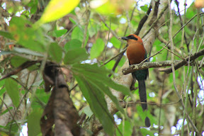
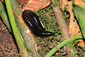
The last place we visited in Ecuador was the town of Mindo, about a 2-hour drive north of Quito. We spent three nights at the Mindo Gardens lodge, which itself was a 45-minute walk from the center of the very small town of Mindo. Mindo is a one-street town with loads of eco-lodges, but little in the way of food. What the area does have going for it is extensive bird activity and zip-lines through the canopy of these high-altitude "cloud forests." Mindo is especially famous for one resident, the Andean Cock-of-the-Rock. Each morning (in secret places only the $100-per-person guides know about) dozens of the male COTRs gather to court lady birds. Rarely do the ladies show up, but it's supposed to be quite the spectacle. However, due to a lack of sufficient funding, we didn't get to see real live Cock-of-the-Rock. We did see lots of other great animals, though, which you can see by clicking through the album.


From Ecuador - Mindo Cloud Forests


From Ecuador - Mindo Cloud Forests


We also engaged in Mindo's other two activities: visiting the butterflies


From Ecuador - Mindo Cloud Forests


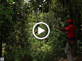
... and hurtling through the canopy on what I'm sure are very safe metal cables


From Ecuador - Mindo Cloud Forests

Tuesday, November 02, 2010

Ecuador: Parque Nacional Cajas

Photos here.

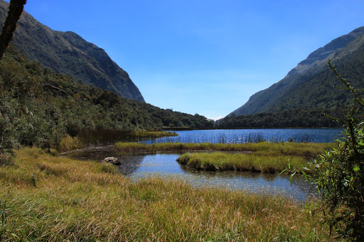
In our second week in Ecuador, we flew south from Quito to the lovely town of Cuenca (we'll have a separate post about that city some day). From Cuenca, we booked a tour to Parque Nacional Cajas, a highlands park notable for it's glacier-formed valleys, hundreds of lakes, and ancient "polylepis" forests.


We saw many cool birds, a bunny, hiked several the lagoons, and walked up to the second-highest point in the park, known as "Tres Cruces," where there is a memorial to the many Spaniards who died while trying to cross the Andes (elevation 13,670 ft.). Interestingly, Tres Cruces is also on the continental divide; which means every drop of water on one side of Tres Cruces flows toward the Pacific, while every drop that falls on the east side goes into the Amazonian basin (and then the south Atlantic).

Cajas' terrain is known as a "paramo" ... basically, high-elevation plains and bogs. It's actually quite similar to some of the terrain we saw above the tree line on the South Island of New Zealand:


From 28Mar07

Compare with Ecuador:


Pretty cool...

Sunday, October 31, 2010

Ecuador: Cotopaxi


All the photos here.

We took a guided day trip from Quito to the nearby national park around the Cotopaxi volcano. The tour company drove us and a few others out to the park, where we would stop below the volcano, at the park's very small museum, and finally, part way up the volcano. From about 3900 m, we would begin a 2 hour walk up to the edge of the glacier at about 5000 m (16,400 ft)... this is probably the highest altitude we've ever hiked to! There is a hut/refuge about half way up the trail to the glacier, where you can get outfitted to do the actual ice climbing to the summit after the sun goes down. We stopped here for lunch on the way down, but the food was bad and there wasn't enough for vegetarians. After lunch, we walked back to the bus and took an 11 km (almost 7 mile) mountain bike ride down the volcano to a lagoon near the park entrance. We also saw an Andean wolf (which is really a fox) and milked a cow! All in all, a very fun tour.

Interesting after story: On another day, we ran in to a woman who recently quit from the tour company we used to go to Cotopaxi. She complained that they underpaid their guides, skimped on food, and treated her terribly. So.... for those of you looking for a particular tour company to use if for Cotopaxi, we can't really recommend one, even though we had a good trip with ours.

Saturday, October 30, 2010

Friday, October 29, 2010

More like this to come...


We are back in America now, and sometime this weekend, probably between World Series games 3 and 4, we'll have a more complete update with stories and pictures. Until then, let this whet your appetite. :)
Posted by Picasa

Thursday, October 28, 2010

An old photo from Quito


This is from our first night in Ecuador, when we met up with our friend who now lives in Berlin. We had dinner at El Arabe, a medeteranean place in the new part of Quito. Actually, this was one of the best meals we had here in Ecuador.

Sunday, October 24, 2010

cafe austria en cuenca, ecuador


Hanging with coffee and wireless at a very touristy place on a sunday morning...