Showing posts with label New Zealand. Show all posts

Tuesday, November 02, 2010

Ecuador: Parque Nacional Cajas

Photos here.

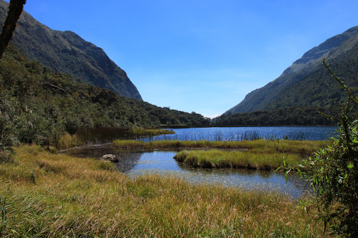
In our second week in Ecuador, we flew south from Quito to the lovely town of Cuenca (we'll have a separate post about that city some day). From Cuenca, we booked a tour to Parque Nacional Cajas, a highlands park notable for it's glacier-formed valleys, hundreds of lakes, and ancient "polylepis" forests.


We saw many cool birds, a bunny, hiked several the lagoons, and walked up to the second-highest point in the park, known as "Tres Cruces," where there is a memorial to the many Spaniards who died while trying to cross the Andes (elevation 13,670 ft.). Interestingly, Tres Cruces is also on the continental divide; which means every drop of water on one side of Tres Cruces flows toward the Pacific, while every drop that falls on the east side goes into the Amazonian basin (and then the south Atlantic).

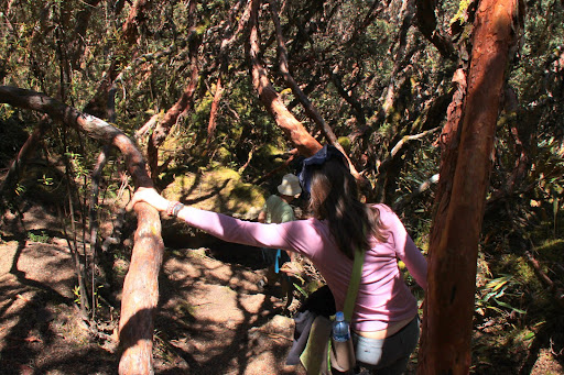
Cajas' terrain is known as a "paramo" ... basically, high-elevation plains and bogs. It's actually quite similar to some of the terrain we saw above the tree line on the South Island of New Zealand:


From 28Mar07

Compare with Ecuador:


Pretty cool...

Monday, May 19, 2008

Some B/W Photos I Took in NZ

I came across a few black and white photos I took in NZ while cleaning up my computer's hard drive. They're not very good because I don't really know how to take artsy photos, but I like them anyway. Enjoy...

-mike.


Posted by Picasa

Monday, May 21, 2007

More Pics

As Justine mentioned in the previous post (see below), we're finally getting around to organizing the 10000 photos we took (literally) while we lived in the other "real world" overseas. You can see them
here. There's only a few and they're all from the S. Island of NZ, but enjoy anyway. More to come....

Thursday, April 19, 2007

Cute!


Same sea lion pup as yesterday, but while she was playing fetch with a stick (by herself!). Did you know sea lions nest in the bushes of sand dunes? Me neither.


Rare yellow-eyed penguins on the S. Island of NZ.

Wednesday, April 18, 2007

Kiwi Crossing, next 1250 km


The obligatory photo from NZ.


Justine is somewhere in this picture. Can you find her?


On the way to Franz Josef Glacier on the S. Island of NZ. That's it coming down the mountain in the back. The water behind me is a glacial river. Very cool ('scuse the pun).

The face of Franz Josef. See the cave at the bottom middle? That's where the river comes out of. Stunning, but the glacier has receded tons in the last few years. Less than 50 years ago (maybe less... I forget the date) the place I took this picture from would have been covered by the glacier.

Sea lion pup from the Catlin's coast (the south-east coast of the S. Island).


Low-res. image of a sea lion pup with his pop.

Fixed the video

in this post from a few days ago. It shows how the wind was so crazy on our Lake Trek on the N. Island of New Zealand. It's only 6 seconds, but it's my favorite video!

Enjoy.

Wednesday, April 04, 2007

Never any time to blog...

We're wrapping things up here in New Zealand, and getting ready to come back to America. There will be ample postings then, so keep your browsers pointed here for further updates and pictures.

For now, a brief summation of our last week.

We walked the 60+ km Kepler Track in Fiordland national park on the S. Island of NZ. It was an excellent walk through alpine scenery and we were visited by several of the only (and very rare) alpine parrot in the world, the Kea. Pics to follow.

The day before we started Kepler, we walked 12 km around the famous Milford Sound and up to Key Summit to see some rare alpine plants and alpine bogs. Really cool.

After Kepler, we spent time on the Catlin's Coast in SE S. Island, and today are in Dunedin. We've been spending time watching sea lions on the beach (and avoiding being chased by them!) and watched a NZ horror/comedy flick today called Black Sheep. It's gold, Jerry! An evil farmer is experimenting with genetically modified sheeps (which outnumber New Zealanders 10 to 1), which go crazy and start eating people and turning them into nasty ware-sheep. Pure comedy.

We'll be back in America on April 11th, my birthday, which will last for something like 40 hours this year as we leave Christchurch around 6 am and we land at LAX at 10 am the same day! Weird.

-Mike.

Sunday, March 25, 2007

More to Whet your Appetite

More pictures to keep you reading our blog... I've found time while we're cleaning up our breakfast (fried eggs, baked beans, toast, and fried onions/bell peppers/tomatos) that we made this morning on the west coast of S. Island NZ. These ones are from our Lake Waikaremoana trek from last week on the N. Island. Enjoy!!


Painting by M, of our approach to Panekiri Bluff in 120 kph winds! Don't believe me, check this video!


Joint painting, mostly by J, of the grassy fields up against the lake at Maruati Hut.


Lake Waikaremoana, 600 m below, from Panekiri bluff.

In the grassy fields around the lake.

Friday, March 23, 2007

Lake Waikaremoana Great Walk

Once again, I'll be skimping on the details here and I'm not posting any pics because the internet in the first world is so expensive!

We arrived in Auckland on Mar. 12 or something, and stayed for several days, checking out the sights, the birds, an island nature reserve, and a mainland "island" reserve which has active predator controls in place (see, when the first humans arrived on NZ's shores about 600 years ago, the brought with them dogs, cats, and other mammals, none of which lived here before, so they all just preyed on the flightless birds and other precious critters 'round there parts).

Then, when we were totally prepared and had bought all our food for our 5-day 4-night trek around Lake Waikaremoana (sounds like "why-CARE-uh-moe-on-uh"), we drove for about 6 hours to Te Urewera National park. We stayed the first night in a motor camp near the track entrance, and took a boat across the lake to start off.

First, we had to climb the ~600 m to the top of Panekiri bluff, a huge stone wall that faces the new rain-water lake (it was formed only 2200 years ago when a landslide blocked up the valley). This was not only a tough climb, but the winds were absolutely crazy. We walked through an exposed saddle point, emerging from the coverage of the forest into 100+ kph winds that literally knocked us over! The hut we stayed at on the top of the bluff (set back a bit, but with still amazing views) was a 30-something bunk hut with running water. We used our Jet Boil (R) to prepare some mashed potatoes, soy protien, and green beans. Delish!!

The next 4 days, the weather was perfect: sunny but cool, light breeze, minimal clouds (only adding to the drama of gorgeous sunsets), and crystal clear skies. We went through multi-varied terrain, from fern forests (complete with 20 and 30-ft. tall fern TREES), river-side beech and birch-like trees and huge old-growth forest (the area around the forest is still-virgin forest, so it's quite old and awe-inspiring to be in there). And on most nights, we listened to the Kiwis call to each other as the sun went down. Very cool.

Look for pics in the coming weeks, most likely after we get back to America in mid-April :(

For more on the lake and other tracks, check out the NZ Department of Conservation. Search for Lake Waikaremoana.

-Mike.