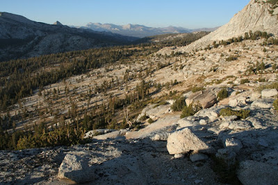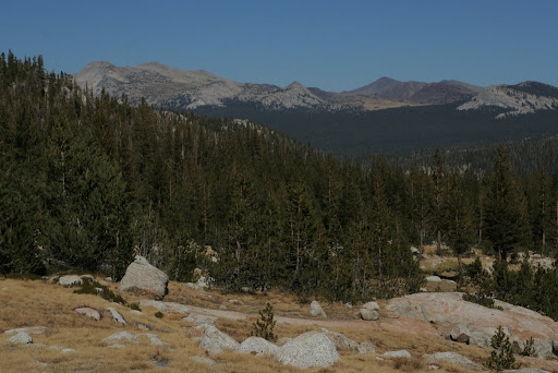
Showing posts with label California. Show all posts

Monday, October 31, 2011

Big Sur Backpacking Trip

Just the photos:

Bottcher's Gap

But if you read all the way through, you'll be treated to a new feature on this blog: videos!


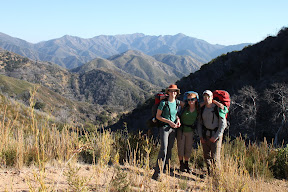
We went backpacking in the Big Sur Ventana Wilderness area, from Bottcher's Gap to Pat Springs over the weekend. We got a bit of a late start on Friday, but it was also kind of cool because we got to hike through a beautiful sunset and into the dusk.

From Bottcher's Gap

It was a pretty grueling hike for Justine and I - pretty much straight up hill for the first 3 or 4 hours. Yikes!

When we finally made camp the first night, it was just on the side of the trail around 7 pm. We stopped near a spur that lead to a small trickle of water, which was enough for the evening and the next morning.

From Bottcher's Gap

Following some amazing mac-n-cheeze+broccoli, we went to sleep intent on getting up early the next morning to finish our walk to Pat Springs. Unfortunately, only one of us managed to get up at sunrise.

From Bottcher's Gap

Oh well... everyone did eventually get up and we at some tofu-scramble-breakfast-burritos. After cleaning up the camp, we headed off (even if some of the crew wanted to pretend we'd already been walking for hours!):


We marched on for a short while through madrone and manzanita forest


and were soon pumping fresh water again at Pat Springs.

From Bottcher's Gap

We took a campsite a few hundred feet uphill from the spring, overlooking Botcher's Gap, the Pacific, Pico Blanco, and Ventana Double Cone... I must say that it was probably one of the best campsites I've ever seen.

From Bottcher's Gap

We had an orienteering lesson:

From Bottcher's Gap

celebrated a birthday with cupcakes:

From Bottcher's Gap

were treated again to a gorgeous sunset:

From Bottcher's Gap

and were so high in the Ventana Wilderness that we could literally jump over the moon!

From Bottcher's Gap

All in all, an excellent weekend.

Can't say enough about how fun this weekend trip was... beautiful weather, great company, and stunning views. Get out there if you've never been.

From Bottcher's Gap

Oh yeah, and did I mention that I'm trying to post video a bit more often on this here blog? Here's one:

Monday, August 08, 2011

Castle Pass Hike

Castle Pass - Click for Photo Alubm


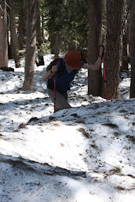
Knocked out another section of the Pacific Crest Trail back on July 17th, the section that adjoins this part, near Donner Pass. The area is called Castle Pass, named for the big black rock formations that look like a giant fort. It was an excellent easy hike, despite being so close to the highway and so snowed in. I guess we shouldn't have been surprised, given the amount of snow this year and the relatively cool summer, but it was surprising that some of the areas were several feet deep with snow!

From Castle Pass

We started the hike very late (around 1pm), bagged an ~8000 ft. peak, and had time to come down and eat an awesome dinner at Lattitudes in Auburn.

From Castle Pass

I said it before and I'll say it again: I love being so close to the Sierras!

Saturday, April 30, 2011

Briones Regional Park Hike


The rest of the pictures here

We used GPS tracker called "Move!Bike Computer" to log the data from our hike; you can view it using GoogleEarth. The batter on our phone only lasted long enough for the hike in (from parking lot to summit), so you can get an idea about where we went and the elevation changes. File here.

Briones is part of the East Bay Regional Parks system. This hike up Lafyette Ridge to a 1350ft. summit, which we took about 3 weeks ago now, was really excellent. Gorgeous day and a nice little climbing challenge over picturesque rolling CA hills with scattered oaks. We did 8 miles round trip and gained a total elevation of about 1000ft, but since the trail was so hilly (see GoogleEarth data above), it ended up being almost twice that. Some of the hills were literally 40% grades... yikes. I really regretted wearing jeans that day.

Monday, February 21, 2011

Yosemite in Winter

I know this is a bit old, now, but I wanted to post these pictures of New Year's Eve and New Year's Day in Yosemite National Park. The snow was crazy and it was so cold on our long snow shoe hike, but it was totally worth it. Enjoy!

New Year's - Yosemite

Monday, September 27, 2010

Yosemite National Park

We went to Yosemite National Park over the weekend... nothing big, just some car camping at Hodgdon Meadow near the Big Oak Flat entrance. We hiked part of the way up Yosemite Falls, but got a late start so we didn't finish. We also hiked down into Merced Grove, a small cluster of Sequoias that doesn't receive nearly the attention it probably deserves (though with bigger, more tourist-friendly areas like Mariposa Grove, I guess it's understandable). Anyway, here's some photos of our trip, including two amazing sunsets (I guess every sunset in Yosemite is amazing), and plenty of cute critters. Enjoy!

Yosemite

Tuesday, July 06, 2010

Two Sierra summits in one day... We love California!


Yesterday, Justine and I went on a relatively short day hike from Donner Pass to the tops of Mt. Donner (where we ate lunch) and Mt. Judah. The Judah trail is supposed to be a loop, but the South side of the trail was snowed in, so we walked out the same way we walked in. One of the coolest things was actually this back tracking, since the afternoon heat significantly increased the flow of the snow melt, causing trails to turn into gushing slides and tiny trickles into full on water features! Click HERE for the pics.


Enjoy, and hope you all had a great 4th!

-mike

Monday, October 13, 2008

Fletcher Peak Panoramic


Four-photo panoramic shot of Vogelsang Lake and Fletcher Peak in Yosemite. (clicky for biggy)


Made with hugin
Posted by Picasa

Sunday, October 05, 2008

Yosemite National Park (Part II)

See Part I below

See Just the Pics.

Album Map


Day 2, 5pm - Lake Merced, West End

Found a hidden campsite on the lake with a well-maintained fire ring. Set up camp, bathed, and ate Indian food. First part of the hike today was crossing the amazing and windy Vogelsang Pass at 11,600 ft. Gorgeous views and crazy granite formations with trees growing right on top of them. Descended pretty quickly into redwood/pine forest and had some good views of Lewis Creek and the surrounding granite Mtns. This was the best part of the hike today... J would have loved it: Soft ground, pretty trees, lots of birds and tiny chipmunks and a few deer really close. But still no bears.
Lake Merced and Half-Dome From Yosemite
Then a grueling 1.5 hr. downhill climb (heavy sun exposure the whole time!) over chipped rock and solid granite surfaces (did I mention that Yosemite is really hard ground? It's not like walking in N. Calif, where the redwood forests keep a lush, soft forest floor. Nope... It's more like walking on concrete in some places and walking on terriblly hard/sharp rocks the rest of the time. Reminds me of certain places in Nepal.) We got a good view of Lake Merced and Hlf-Dome in the distance (see above) but we dropped 4K ft in just 6 miles! It was really tough, especially b/c noone told us we wouldn't see water until the bottom. Oh well. We made it to the lake and I'm pretty sore and tired. Dan's knees are bothering him, my hips are bruised from the backpack, and my feet are killing me from the pounding on the stone. I realize that last night I had pretty bad bad.... nausea, loss of appetite, headache.... glad all that's gone, now.

Today's views were great but the walk was brutal. I can't imagine going the opposite way, but sure 'nuff, we crossed paths with a few. The campsite we're at now has lots of cute birds and a few mosquitos are bugging us, but hopefully smoke from the fire will get rid of them. Also, we saw a small black snake and a big black lizard with a blue chin. Crazy.

Day 3 - Lima Bean Lake, ~1 mile north of Long Meadow

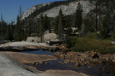
I was really slow and tired on the trail today. The beautiful Echo Valley (just past Lake Merced) quickly gave way to a short climb up a sheer granite face (via many switchbacks) and then we were in this amazing meadow that had recently burned. Huge granite peaks towered over us all around. We made good time through the meadow, surrounded by short pines and huge old burned ones, which shared the space with tall grasses and shurbs. Amazing scenery. Hopefully the photos do justice. When we came out of the meadow, we hit a small climb that brought us to a water-smoothed granite surface with a trickle of Echo Creek running through it and a bunch of flat rocks that made for the perfect lunch spot. The sun was out, a gentle breeze was blowing, there was shade, fresh cool water, and a huge sharp peak to one side and a deep glacial valley on the other side (where we had come from)... these are the moments and places that will really stick out in my memory! Then we had another (slow) climb to finish off the day's 2000 ft. elevation gain (over 6 miles) to put us back around 10 K feet in beautiful Long Meadow.

From Yosemite - Showing the Perfect Lunch Spot

Then a funny thing happened. See, we had been planning on staying around Long Meadow b/c the topo map shows lots of water and creeks around that area. In fact, one of the backpacker's campsites is there, as is a summer-only High Sierra Camp. So we told one of the wilderness rangers: "hey... we're gonna stay up in Long Meadow near Sunrise Lakes." They told us we'd be fine and that's a good place to stay because there's water up there. Great. The only problem was that although the whole meadow (all 2 miles long by half-a-mile wide of it) was bone dry!

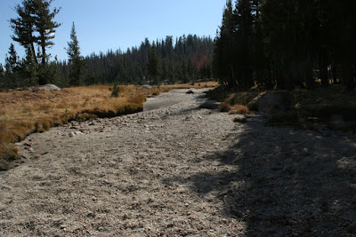
From Yosemite - Showing the dried-up Echo Creek in Long Meadow


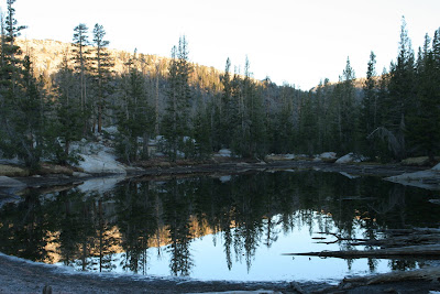
No water had touched the bottoms of those watering holes in weeks! Dry, cracked clay and yellowing grasses were plentiful, but water was nowhere to be seen. Even a huge section of Echo Creek was bone dry! Things were getting serious, too, since it was already 4 pm and Cathedral Lakes -- the nearest source of permanent water in the direction we were supposed to be going tomorrow -- were about 4 miles away. There's a small chance we would have rolled in to Cathedral Lakes just before sunset, but it would have been tough since my knee was really causing me problems on hills today. Well, we saw a small lake about a mile away to the North (the direction of travel for tomorrow, anyway) and about a quarter-mile off the trail. It was un-named and didn't have a real trail going towards it, but it looked pretty flat around there and it was at least on the way to Cathedral Lakes... So we chanced it, and even though the creeks that drain this little mud hole (which Dan kept calling "Lima Bean Lake") were bone dry, too, there was still some water. Yay!

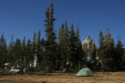
From Yosemite - Showing the best campsite ever!


We had a great snack while watching the sunset (black bean hummus and tortillas) and made a fire and ate dinner. A great evening in the best campsite (see link and see above) we've had all trip!

From Yosemite - The mud hole that offered us water at sunrise on Saturday


I'm so glad I could get out here. Calif. can be dry and dusty but it's so pretty.... Being in Texas, now, I really miss the mountains and it's so great to get fresh air and water.


Okay... sorry this second posting took so long to get up. It appears there will have to be a Yosemite (Part III) posted later this week, whenever I get time. We've had visitors last week and again this week, so keep your browsers pointed here for updates (or better yet, simply get the feed so that you know whenever there's updates!)

Saturday, October 04, 2008

Yosemite National Park


Just the Photos for the Lazy People (you know who I'm talking about... I'm talking about everyone who just clicks the link and doesn't read the whole post!)

Yosemite


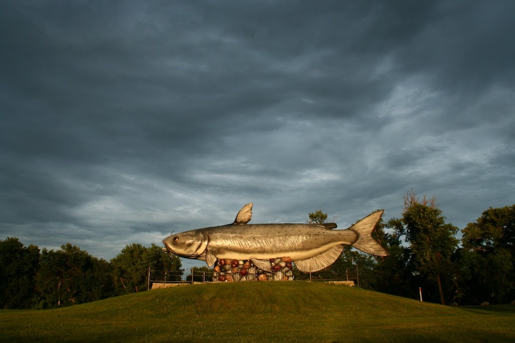
Wow... last post July 12th... that's embarrassing! Well, Justine and I haven't done too much travel since then, but I did go to Chicago for a conference (loved it, wanna move there) and I went to Norff Dakota (see also the 100-ft Whoppy the Whopper statue at right!) for a family reunion (loved it b/c of the family, would never move there!), and we went back to LA to go to a wedding between two good friends of ours (we [heart] LA, stayed with our travelin' soul mates, had an awesome time at the wedding, and would love to move back).

Actually, that's quite a bit of traveling. I should have been doing a better job with this here blog! But also, for those in the know, things have been quite crazy around here lately for personal/family matters. Hopefully that stuff's falling by the wayside and we can get back to being international travelers. Okay, on with the show.

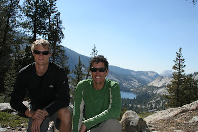
Last week, J went to visit her friend in Seattle for 10 days (she can blog about that if she wants) and I went backpacking with a buddy of mine (Dan) in the high Sierras in Yosemite National Park. I had not been there since I was about 7 or 8, so I really didn't know what to expect, and to be honest, this was going to be my first "real" backpacking trip of more than one night (meaning wilderness camping with no facilities except what's on our backs). My friend Danielle (no relation to Dan, but he did leave the door open for her one time just in case she wanted to stop by), who frequents the back country of Yosemite, offered me some suggestions of where to go, and so I prepared this map (clickable with details and also below... note that they don't have "mountain" icons for some reason, so Half Dome and El Capitan are labeled as Volcanoes...) of our possible 4-day journey (each potential day's hike in a different color, with various optional side trips and different paths to take). So we packed up -- meaning, I packed up a bunch of gear for two people and Dan just showed up with a backpack and some food in an on-loan-from-my-father-in-law beater car -- and headed out. Did you know that Yosemite is really far away from San Jose Airport? It is. And then once you're inside, it takes 90 minutes just to get to Tuolome Meadows, where we wanted to start out hike. Crazy.


View Larger Map

Okay, so the actual hike we took was very close to the map given above. It included on night of car camping at T.M. (8600 ft), hiking up via Rafferty Creek to Vogelsang Lake (11000 ft) and camping there (inside blue path on the map), climbing over Vogelsang Pass (11600 ft) and descending to Lake Merced (7600 ft) to camp there (outside purple path on the map) the third night, walking up to Long Meadow / Echo Creek / Sunrise Lakes area (9500 ft) for the fourth night (inside red path on the map), then walking out past Cathedral lakes (yellow path). Notes are from my journal...

Day 1 - Tuolome Meadows to Vogelsang Lake

After a grueling hike (for me, anyway) up Rafferty creek, we found a spot on the So. side of the lake close to Vogelsang pass at 11,600 ft. (note that the contour lines on google maps are about 1000 ft lower than the lines on my official Yosemite topo map... I trust Nat. Geo. more than I trust Google on that detail, so I'll stick with the elevations as given in my Topo). Our campsite was ~11,200 ft., so a small climb tomorrow will put us on the pass for a 4K-ft descent into Echo Valley. There were essentially 3 legs to today's hike: the first was a long, steep climb from T.M. to an alpine-like meadow that J would have loved! Yellow grasses, small bushes (with all kinds of reds and golds) clung to rocks, and miniature pines. The weather was perfect for hiking: sunny, breezy, ~65 degrees, not a cloud in the sky. The second leg was much shorter and was another uphill from that meadow thru. a pine forest and up thru. the Cathedral Mtns. There's a fork on the road to Boothe Lake or Vogelsang and we took the latter, which led to the 3rd stage: climbing over granite surfaces and exposed rock faces to the lake (about 1 mile beyond the luxurious, but closed, Vogelsang High Sierra Camp). I was fully exhausted at the end!

From Yosemite


Dan and I ate right when we got here and enjoyed drinking fresh mountain water (filtered and chlorinated, of course, to prevent Giardia infection!). Then we climbed some rocks to the other side of the lake to watch the sunset behind Half Dome and the amazing pink light hitting Fletcher Peak and Vogelsang Lake. Pretty cool, but we both had bad headaches (altitude sickness) and it's getting quite cold in the evening now that the sun has gone down. I'm feeling really ill, right now, and am going to crash any second. Nausea, terrible headache, the shakes... I'm done. Dan can clean up. Watch out for bears, Dan... I need to sleep and get warm.

Day 2 (morning) Still at Vogelsang Lake
Feel much better now and slept much better than the first night (car camping in T.M.) and I don't think it got as cold up here as it did then (it dropped below freezing in T.M.). Being here reminds me how dry Calif. is... even here where there's lakes and streams all over, the grasses and trees are all brown and dried out. It's still very pretty and the alpine areas are so amazing (we saw a single tiny yellow flower frowing out of the crack in ta rock, sheltered from the winds... "life goes on" said Dan). i wish I had warmer clothes for the mornings or we could build a fire right now! Actually, besides today, we should be able to build a fire in the AM, which will help a lot. I'm really glad dan was able to come along. I forgot how much I needed to get out and do this kind of stuff... Funny thing about last night: when we went up to watch the sunset before I totally bailed and stumbled my way back to the campsite, I thought the sun was about to go down so we hurried to climb this crest and watch, but it took over an hour for the sun to actually go down!


More Coming To Come Later This Weekend, So Keep Your Eyes Peeled...