 Just the Photos
 for the Lazy People (you know who I'm talking about... I'm talking about everyone who just clicks the link and doesn't read the whole post!)
Wow... last post July 12th... that's embarrassing! Well, Justine and I haven't done too much travel since then, but I did go to
Chicago for a conference (loved it, wanna move there) and I went to
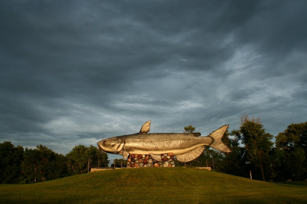
Norff Dakota (see also the 100-ft Whoppy the Whopper statue at right!) for a family reunion (loved it b/c of the family, would never move there!), and we went back to
LA to go to a wedding between two good friends of ours (we [heart] LA, stayed with our travelin' soul mates, had an awesome time at the wedding, and would love to move back).
Actually, that's quite a bit of traveling. I should have been doing a better job with this here blog! But also, for those in the know, things have been quite crazy around here lately for personal/family matters. Hopefully that stuff's falling by the wayside and we can get back to being international travelers. Okay, on with the show.
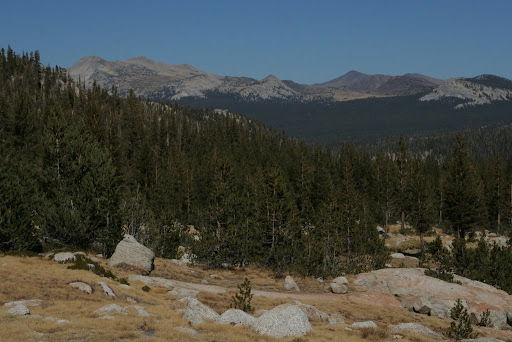
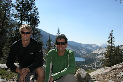
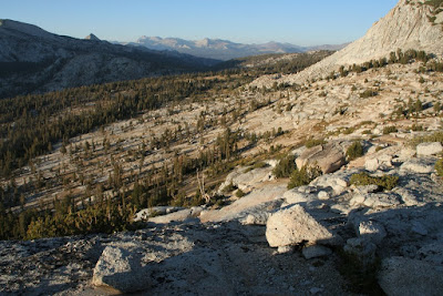
Last week, J went to visit her friend in Seattle for 10 days (she can blog about that if she wants) and I went backpacking with a buddy of mine (Dan) in the high Sierras in Yosemite National Park. I had not been there since I was about 7 or 8, so I really didn't know what to expect, and to be honest, this was going to be my first "real" backpacking trip of more than one night (meaning wilderness camping with no facilities except what's on our backs). My friend
Danielle (no relation to Dan, but he did leave the door open for her one time just in case she wanted to stop by), who frequents the back country of Yosemite, offered me some suggestions of where to go, and so I prepared this
map (clickable with details and also below... note that they don't have "mountain" icons for some reason, so Half Dome and El Capitan are labeled as Volcanoes...) of our possible 4-day journey (each potential day's hike in a different color, with various optional side trips and different paths to take). So we packed up -- meaning, I packed up a bunch of gear for two people and Dan just showed up with a backpack and some food in an on-loan-from-my-father-in-law beater car -- and headed out. Did you know that Yosemite is really far away from San Jose Airport? It is. And then once you're inside, it takes 90 minutes just to get to Tuolome Meadows, where we wanted to start out hike. Crazy.
View Larger MapOkay, so the
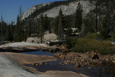
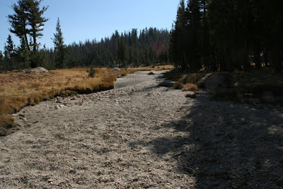
actual hike we took was very close to the map given above. It included on night of car camping at T.M. (8600 ft), hiking up via Rafferty Creek to Vogelsang Lake (11000 ft) and camping there (inside blue path on the map), climbing over Vogelsang Pass (11600 ft) and descending to Lake Merced (7600 ft) to camp there (outside purple path on the map) the third night, walking up to Long Meadow / Echo Creek / Sunrise Lakes area (9500 ft) for the fourth night (inside red path on the map), then walking out past Cathedral lakes (yellow path). Notes are from my journal...
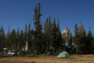
Day 1 - Tuolome Meadows to Vogelsang LakeAfter a grueling hike (for me, anyway) up Rafferty creek, we found a spot on the So. side of the lake close to Vogelsang pass at 11,600 ft. (note that the contour lines on google maps are about 1000 ft lower than the lines on my official Yosemite topo map... I trust Nat. Geo. more than I trust Google on that detail, so I'll stick with the elevations as given in my Topo). Our campsite
was ~11,200 ft., so a small climb tomorrow will put us on the pass for a 4K-ft descent into Echo Valley. There were essentially 3 legs to today's hike: the first was a long, steep climb from T.M. to an alpine-like meadow that J would have loved! Yellow grasses, small bushes (with all kinds of reds and golds) clung to rocks, and miniature pines. The weather was perfect for hiking: sunny, breezy, ~65 degrees, not a cloud in the sky. The second leg was much shorter and was another uphill from that meadow thru. a pine forest and up thru. the Cathedral Mtns. There's a fork on the road to Boothe Lake or Vogelsang and we took the latter, which led to the 3rd stage: climbing over granite surfaces and exposed rock faces to the lake (about 1 mile beyond the luxurious, but closed, Vogelsang
High Sierra Camp). I was fully exhausted at the end!
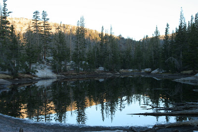
Dan and I ate right when we got here and enjoyed drinking fresh mountain water (filtered and chlorinated, of course, to prevent Giardia infection!). Then we climbed some rocks to the other side of the lake to watch the sunset behind Half Dome and the amazing
pink light hitting Fletcher Peak and Vogelsang Lake. Pretty cool, but we both had bad headaches (altitude sickness) and it's getting quite cold in the evening now that the sun has gone down. I'm feeling really ill, right now, and am going to crash any second. Nausea, terrible headache, the shakes... I'm done. Dan can clean up. Watch out for bears, Dan... I need to sleep and get warm.
Day 2 (morning) Still at Vogelsang LakeFeel much better now and slept much better than the first night (car camping in T.M.) and I don't think it got as cold up here as it did then (it dropped below freezing in T.M.). Being here reminds me how dry Calif. is... even here where there's lakes and streams all over, the grasses and trees are all brown and dried out. It's still very pretty and the alpine areas are so amazing (we saw a single tiny yellow flower frowing out of the crack in ta rock, sheltered from the winds... "life goes on" said Dan). i wish I had warmer clothes for the mornings or we could build a fire right now! Actually, besides today, we should be able to build a fire in the AM, which will help a lot. I'm really glad dan was able to come along. I forgot how much I needed to get out and do this kind of stuff... Funny thing about last night: when we went up to watch the sunset before I totally bailed and stumbled my way back to the
campsite, I thought the sun was about to go down so we hurried to climb this crest and watch, but it took over an hour for the sun to actually go down!
More Coming To Come Later This Weekend, So Keep Your Eyes Peeled...

